Located in the eastern Baltic Sea, north of Finland, East and south of Russia and Estonia. It covers an area of about 30,000 square kilometers. It is 390 kilometers east-west, 70 kilometers wide at the entrance and 130 kilometers wide at the middle. The north bank is steep and winding, with many islands; the East and south banks are low and flat. The general depth is 20-30 meters, and the deepest is at the entrance of the West end, which reaches 115 meters. There are Nirva River, Narva River and other injections. The Soima Canal opens to this bay. The freezing period is 3-5 months. Salinity is 3-6. Depth and salinity increased gradually from east to west.
핀란드 만 리뷰
4.6 /580건의 리뷰


1 / 9

5/5
핀란드 만
작성일: 2017년7월3일

2 명이 해당 게시물을 좋아합니다
좋아요
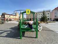 5/5완벽해요!원문보기
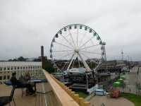
높은 각도에서 보면 매우 아름답습니다. 아침에 화창할수록 아름다운 색상.
작성일: 2023년11월23일0 5/5완벽해요!원문보기
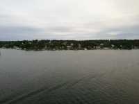
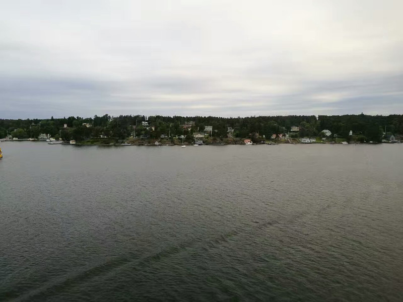
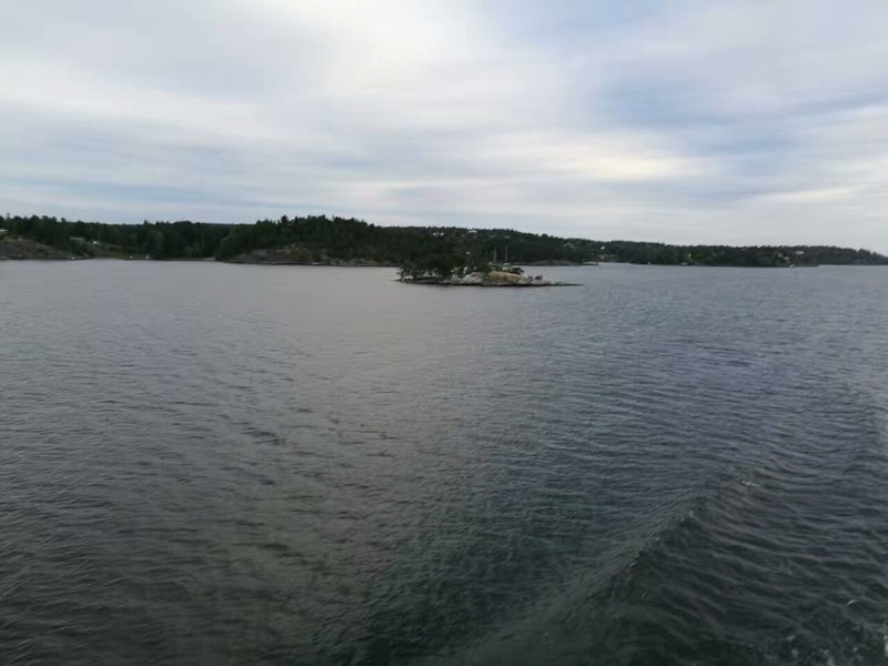
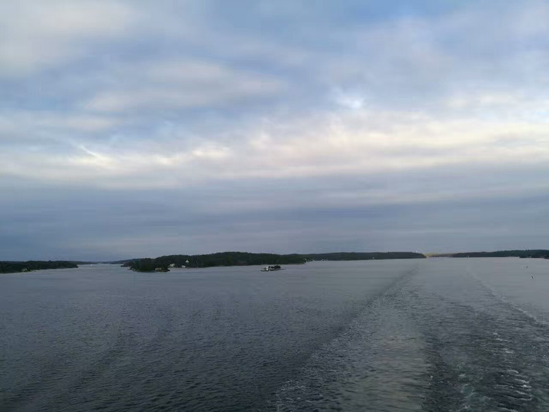
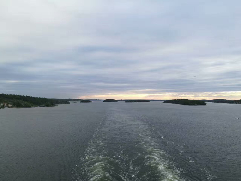
핀란드 만은 약 30,000 평방 킬로미터의 면적을 가진 가늘고 길다. 동서 길이는 약 400km, 평균 수심은 40m, 입구 너비는 70km, 중앙에서 가장 넓은 부분은 130km입니다. 남북으로 19km ~ 128km. 북쪽 해안은 가파르고 구불구불하며 많은 섬이 있으며 동쪽 해안과 남쪽 해안은 낮습니다.
작성일: 2023년6월10일0 5/5완벽해요!원문보기
핀란드, 에스토니아 및 러시아 사이에 위치한 발트해 동쪽의 만입니다. 해수의 소금 함량은 낮고 빙기 3-5 달입니다. 소금도 3 ‰ - 6 ‰, 깊이와 소금도는 동쪽에서 서쪽으로 점차 증가합니다.
작성일: 2022년12월17일0 4/5최고에요!원문보기
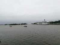
핀란드 만 (영어 : 핀란드 만, 러시아어 : Финскийзалив, 핀란드어 : Suomen Lahti)은 핀란드, 에스토니아 및 러시아 사이에 위치한 발트해 동부의 만입니다. 해수는 소금을 함유하고 있으며, 빙기 3-5 달입니다. 핀란드 만 내항은 수직과 수평이며 주요 항구는 핀란드 포카라, 헬싱키 및 코트카, 러시아 위부르크, 상트페테르부르크, 카랑슈타트, 에스토니아 탈린입니다.
작성일: 2023년8월27일0 5/5완벽해요!원문보기
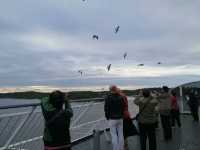
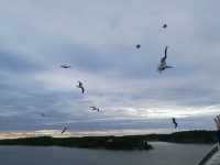
There are countless seagulls in the beautiful Baltic Sea, cruise ships and seaside markets in Finland, and numerous seafood sales in these markets are very quiet seaside. Because it's cold here so there's no warm beach and river game in the Philippines, it belongs to the coastal city in the frigid zone.
작성일: 2016년11월28일3- 1
- 2
- 3
- 4
- 16
핀란드 만 관련 FAQ (자주하는질문)
더 보기
베스트 추천 여행지
인기 여행지 속 추천 관광지
내 주변 서울 관광지 | 내 주변 제주 관광지 | 내 주변 부산 관광지 | 내 주변 오사카 관광지 | 내 주변 도쿄 관광지 | 내 주변 후쿠오카 관광지 | 내 주변 방콕 관광지 | 내 주변 나트랑 관광지 | 내 주변 다낭 관광지 | 내 주변 타이베이 관광지 | 내 주변 청주 관광지 | 내 주변 호치민시티 관광지 | 내 주변 세부 관광지 | 내 주변 홍콩 관광지 | 내 주변 푸꾸옥 섬 관광지 | 내 주변 대구 관광지 | 내 주변 삿포로 관광지 | 내 주변 발리 관광지 | 내 주변 서귀포 관광지 | 내 주변 하노이 관광지 | 내 주변 상하이 관광지 | 내 주변 마닐라 관광지 | 내 주변 인천 관광지 | 내 주변 코타키나발루 관광지 | 내 주변 싱가포르 관광지 | 내 주변 시드니 관광지 | 내 주변 울란바토르 관광지 | 내 주변 오키나와 관광지 | 내 주변 파리 관광지 | 내 주변 쿠알라룸푸르 관광지
인기 관광지
바나힐 골든 브릿지(신의 손 다리) | 한국민속촌 | 난쉰구전 | 청와대 | 레고랜드 캘리포니아 | 구엘 공원 | 마카오 타워 | 선월드 케이블카역 | 제주동문시장 | 서울 여의도 밤도깨비 야시장 | 빈원더스푸꾸옥 | 보라카이 섬 | 유니버설 스튜디오 할리우드 | 하이네켄 박물관 | <장한가(장헌거)>공연 | 싱가포르 플라이어 | 황푸강 유람선 | 알로나 비치 | 앙헬 폭포 | 맥케비 공원 | Czechówka | philadelphia zoo | Mukaiyama Kofungun Park | Texu de Santa Eulalia de Abamia | Kosse Homecoming Street Dance | İbrahim Halilullah Cami | Lavka | Mrtvé rameno Vitovské | Cartel de Mercedes | Ghibli Park
인기 트래블로그
서울 트래블로그 | 제주 트래블로그 | 부산 트래블로그 | 오사카 트래블로그 | 도쿄 트래블로그 | 후쿠오카 트래블로그 | 방콕 트래블로그 | 나트랑 트래블로그 | 다낭 트래블로그 | 타이베이 트래블로그 | 호치민시티 트래블로그 | 세부 트래블로그 | 홍콩 트래블로그 | 푸꾸옥 섬 트래블로그 | 대구 트래블로그 | 삿포로 트래블로그 | 발리 트래블로그 | 서귀포 트래블로그 | 하노이 트래블로그 | 상하이 트래블로그 | 마닐라 트래블로그 | 인천 트래블로그 | 코타키나발루 트래블로그 | 싱가포르 트래블로그 | 시드니 트래블로그 | 울란바토르 트래블로그 | 파리 트래블로그 | 오키나와 트래블로그 | 쿠알라룸푸르 트래블로그
인기 순위 차트
쯔창 주변 인기 패밀리 추천 명소 | 도쿄 럭셔리 레스토랑 | 우이 럭셔리 호텔 | 후지카와구치코 정 현지 풍미의 식당 베스트 8 | 아와지 주변 인기 럭셔리 호텔 | 타르비시오 주변 인기 럭셔리 호텔 | 아테네 클럽 베스트 12 | 셍-발르히-슈흐-솜 주변 인기 럭셔리 호텔 | 파그 주변 인기 럭셔리 호텔 | 케포스 럭셔리 호텔 | Mairipora 럭셔리 호텔 | 트빌리시 클럽 베스트 10 | 나라 명물 디저트 베스트 23 | 콤보르니아 주변 인기 럭셔리 호텔 | 스주현 주변 인기 패밀리 추천 명소 | 라하이나 주변 인기 럭셔리 호텔 | 파아루퓌시 럭셔리 호텔 | 칭다오 럭셔리 레스토랑 베스트 8 | 레이캬비크 바 (Bar) 베스트 8 | 즈단 주변 인기 패밀리 추천 명소 | 도쿄 야간 관광지 베스트 19 | 서울 야간 관광지 베스트 11 | 방콕 야간 관광지 베스트 10 | 마카오 야간 관광지 베스트 12 | 오클랜드 야간 관광지 | 로스엔젤레스 야간 관광지 | 토론토 야간 관광지 | 쿠알라룸푸르 야간 관광지 베스트 7 | 두바이 야간 관광지 베스트 5 | 샌프란시스코 야간 관광지
결제 방법
트립닷컴 제휴사
Copyright © 2024 Trip.com Travel Singapore Pte. Ltd. All rights reserved.
사이트 운영자: Trip.com Travel Singapore Pte. Ltd. (라이선스 번호 02943, 대표 오이치통)
Unit No. #29-01, 30 Raffles Place, Singapore 048622
고객센터: 한국 1666 0060 해외 +82 2 6917 8777
사이트 운영자: Trip.com Travel Singapore Pte. Ltd. (라이선스 번호 02943, 대표 오이치통)
Unit No. #29-01, 30 Raffles Place, Singapore 048622
고객센터: 한국 1666 0060 해외 +82 2 6917 8777